Best Inspection Drones in Canada 2026 - Top 5 Picks for Safety, Accuracy, and Value
Published on Saturday, January 24, 2026
Inspection drones offer a safe and efficient way to conduct visual inspections of infrastructure, buildings, and facilities. They reduce the need for scaffolding or ladders while providing high-resolution imagery for thorough assessments. In Canada, inspection drones are increasingly popular across utilities, oil and gas, telecom, construction, and municipal infrastructure because they cut operational risk, save time and cost, and enable data-driven maintenance decisions in remote and harsh climates. Canadian buyers prioritize cold-weather performance, rugged build quality, integrated sensors such as thermal cameras and LiDAR, long flight times, compliance with Transport Canada rules, and local service support. The top inspection drones for 2026 combine modular payloads, advanced autonomy, on-board AI for defect detection, and seamless integration with photogrammetry and asset-management software.
Top Picks Summary
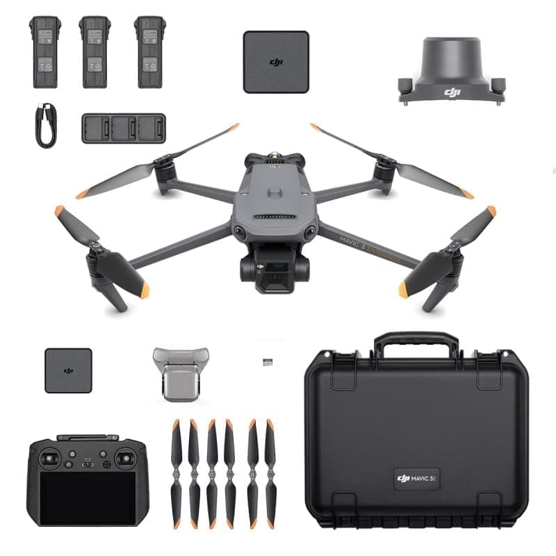
The Matrice 30T is a compact, integrated drone tailored to rapid pipeline patrols with a built-in thermal camera and streamlined deployment for frequent inspections. It trades the 350 RTK’s payload flexibility for lower acquisition and operating overhead, making it a cost-effective option for routine external line checks and thermographic leak detection, while remaining less capable than the Elios 3 for confined interiors and less autonomous than Skydio’s X10. Its balance of thermal sensing, portability and enterprise support makes it ideal for teams needing quick, repeatable surveys without the expense of a larger platform.

$12,000-16,000 CAD
The DJI Mavic 3 Thermal pairs foldable portability with integrated thermal and high-resolution RGB imaging, making it an excellent mid-tier solution for small to medium solar arrays and rapid field deployments. It is more affordable and easier to deploy than the Matrice series while still providing sufficient thermal performance for routine hotspot detection, though it lacks the payload flexibility and RTK precision of larger enterprise platforms.
$5,500-7,500 CAD
The Skydio X2 is renowned for its autonomous flight capabilities, equipped with industry-leading AI that allows it to navigate complex environments with ease. Its advanced obstacle avoidance technology and real-time processing capabilities enable it to perform missions safely and efficiently. Designed with enterprise users in mind, the X2 offers comprehensive tools for data collection and analysis. Its rugged design ensures durability in tough conditions, making it a top choice among businesses looking for reliable drone solutions.
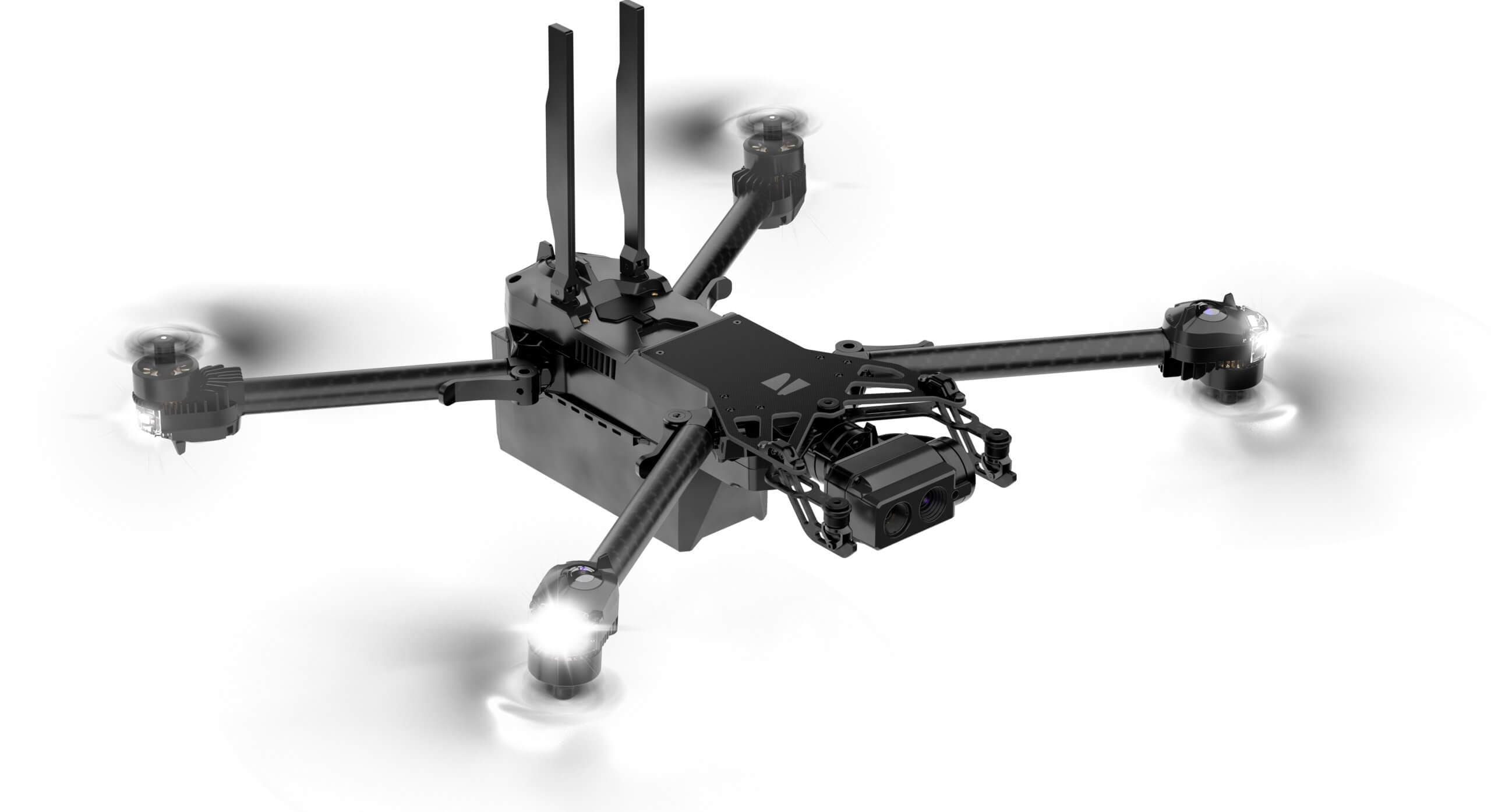
8000-10000$
The Elios 3 is a collision-tolerant, caged inspection drone built specifically for confined spaces such as tunnels, underpasses and inside culverts—areas where open-air drones cannot safely operate. It earns a niche market-leader spot for railway inspections that require interior tunnel mapping or close-proximity checks because it reduces the need for personnel entry and associated safety costs. Available for purchase, it complements open-air platforms like DJI and Skydio rather than replacing them, offering unique technical value for internal asset inspections that larger drones cannot accomplish.

$35,000-55,000 CAD
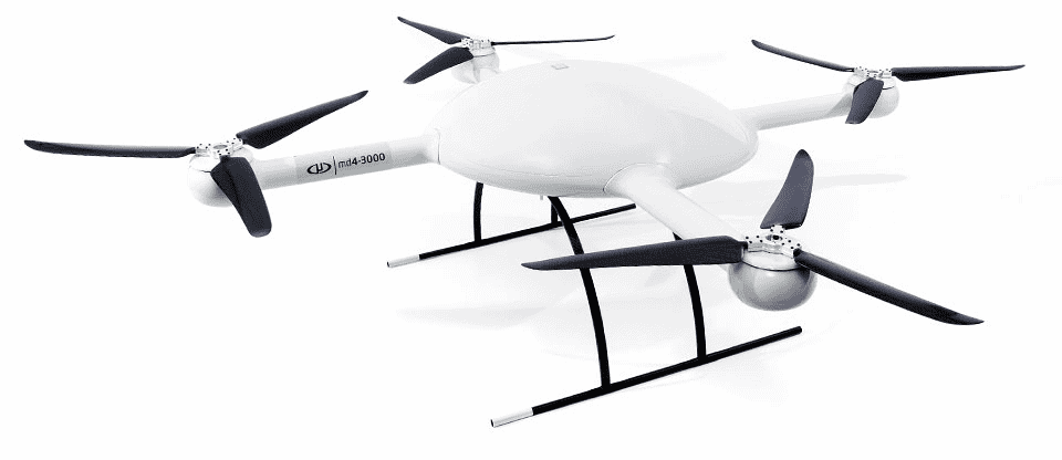
Microdrones' MD4-3000 is recognized for its professional-grade surveying and mapping capabilities, making it a top choice in various industries. Its robust build and high payload capacity enable the use of multiple sensors, providing exceptional data accuracy and quality. The drone's versatility and ease of use empower land surveyors and engineers to deploy it efficiently for various applications. With a high level of automation, this UAV significantly improves workflow efficiency and reduces operational costs.
What the Research and Trials Say
A growing body of studies and field trials has shown that drone-based inspections can improve safety and efficiency compared with traditional methods. Research and industry trials highlight benefits including reduced worker exposure to hazards, faster data collection, and improved documentation quality through high-resolution imagery and sensor fusion. Canadian trials and international research emphasize the value of thermal imaging for detecting moisture and electrical faults, and LiDAR or photogrammetry for accurate dimensional mapping. Regulators and infrastructure owners are also evaluating standards and best practices to ensure safe, repeatable inspection operations.
Safety: Trials and reports indicate drones reduce the need for workers to access high-risk locations, lowering exposure to falls and environmental hazards.
Time and cost: Reports and case studies commonly show significant reductions in on-site inspection time and associated costs when drones replace scaffolding and rope access.
Detection and accuracy: Thermal cameras, multispectral sensors, and LiDAR improve detection of faults such as insulation failures, water intrusion, and structural anomalies when combined with analytics.
Data quality: High-resolution photos and 3D photogrammetry provide repeatable, verifiable records that support condition monitoring and lifecycle planning.
Autonomy and analytics: On-board and cloud-based AI tools accelerate defect identification and reduce manual review time while maintaining traceability.
Regulatory context: Transport Canada regulations guide safe operations and the adoption of beyond visual line of sight and commercial inspection flights under approved processes.
Frequently Asked Questions
Which drone on this list is best for thermal pipeline and external line inspections?
The DJI Matrice 30T. It carries an integrated 640×512 radiometric thermal camera plus a 48 MP zoom camera, has an IP55 all-weather chassis rated to -20°C, and offers up to 41 minutes of flight time, which makes it well suited to thermographic leak detection and routine external pipeline patrols in Canadian conditions.
What is the best option for inspecting confined spaces like tunnels, tanks, and culverts?
The Flyability Elios 3. Its collision-tolerant spherical cage lets it fly safely inside pipelines, tanks, and culverts where open-air drones cannot operate, and its onboard LiDAR with SLAM builds 3D maps in GPS-denied interiors. Flight time is up to about 12 minutes, shorter with the LiDAR surveying payload.
Which compact drone suits smaller solar-array and routine field inspections?
The DJI Mavic 3 Thermal. It folds for easy transport and pairs an integrated thermal sensor with a high-resolution RGB camera, making it a cost-effective choice for hotspot detection on small to mid-size solar sites. It trades the payload flexibility and RTK precision of the larger Matrice platforms for portability and lower operating cost.
Is the Skydio X2 still the most autonomous choice on this list?
The Skydio X2 is known for strong AI-driven autonomous flight and obstacle avoidance for tower and structure inspections, but it is now a legacy model that Skydio has succeeded with the X10. If you need a current enterprise autonomy platform, evaluate the X10; the X2 remains capable where autonomous navigation in GPS-limited environments is the priority.
Conclusion
Inspection drones are a practical, evolving solution for Canadian infrastructure and facility managers who need safer, faster, and more data-rich inspections. We hope this overview of the top 5 inspection drones for 2026 helped you find the right direction. If you want to refine results by industry, sensor type, or budget, use the search to narrow or expand your options.