Top 5 Aerial Photogrammetry Drones in Canada, 2026
Published on Thursday, January 1, 2026
Aerial photogrammetry drones capture high-resolution images to create accurate maps and models. They are ideal for capturing detailed geographic data over large areas, making them essential tools in various industries such as agriculture, construction, mining, and environmental monitoring. The appeal of these drones in Canada comes from their ability to provide precise and efficient data collection, which is pivotal in a country known for its vast and diverse landscapes. With advancements in drone technology, Canadian consumers are increasingly leaning towards these innovative solutions for both commercial and recreational applications.
Top Picks Summary
DJI Matrice 300 RTK
The DJI Matrice 300 RTK is an unparalleled industrial drone that combines an impressive 55 minutes of flight time with advanced AI capabilities. This drone stands out with its robust design, weather resistance, and powerful payload options, making it ideal for various applications such as surveying, inspections, and search & rescue missions. Its dual control system allows for seamless teamwork and operation at a distance, enhancing productivity. Additionally, its RTK technology ensures centimeter-level accuracy, setting it apart from competitors.
10000-13000$
DJI Phantom 4 RTK
The DJI Phantom 4 RTK offers professional-grade mapping and surveying capabilities in a compact, easy-to-fly design. Its integrated RTK module provides high-precision positioning, allowing users to capture accurate data for GIS and mapping applications. Notably, it features advanced obstacle sensing and avoidance systems, ensuring safe operations even in complex environments. With an intuitive app interface and rapid deployment, the Phantom 4 RTK is an excellent choice for professionals seeking reliability and efficiency.

6000-8000$
WingtraOne GEN II
The WingtraOne GEN II revolutionizes drone mapping with its unique fixed-wing and vertical take-off and landing design, enabling efficient large area coverage without compromising on detail. It captures high-resolution imagery with a range of compatible cameras, making it ideal for agriculture, construction, and environmental monitoring. Its user-friendly operation and sophisticated software integration streamline the surveying process, allowing for quick data acquisition and analysis. This makes the WingtraOne GEN II a leading choice for professionals in need of precision mapping solutions.

20000-25000$
Quantum Systems Trinity F90+
The Quantum Systems Trinity F90+ stands out for its combination of vertical take-off and landing (VTOL) and fixed-wing capabilities, offering the best of both worlds. This versatility allows it to cover large areas while still providing detailed, high-resolution imagery and data collection. Its advanced autopilot system ensures reliable flight navigation and precise data capture for various applications, from agriculture to mapping. Furthermore, its lightweight and portable design enables easy deployment in diverse terrains, making it a top choice for professionals across industries.
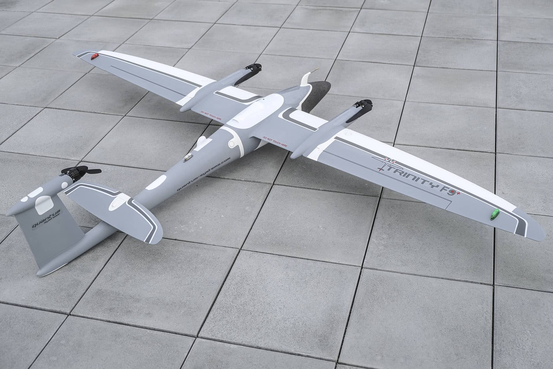
7000-9000$
senseFly eBee Geo
The senseFly eBee Geo is engineered for precision mapping and surveying, making it an industry leader in the drone sector. This fixed-wing drone is lightweight and boasts exceptional flight endurance, allowing users to cover large areas within a single flight while providing high-resolution images and reliable data. Its intuitive software integration simplifies the process of flight planning and data analysis, catering to professionals in various fields, including construction and agriculture. The eBee Geo is known for its accuracy and efficiency, setting it apart from traditional survey methods.

20000-22000$
State-of-the-art cameras and software for efficient image processing and accurate data extraction.
Understanding Aerial Photogrammetry Drones
Explore how aerial photogrammetry drones transform data collection with cutting-edge technology and precise imaging.
Utilize high-resolution imaging sensors to capture intricate details necessary for accurate mapping.
Incorporate GPS technology for precise geolocation, essential for creating reliable geographic databases.
Integrate advanced software for real-time data processing, reducing the time from data capture to actionable insights.
Support various industries such as agriculture and mining by enhancing site planning and resource management.
Facilitate environmental studies by providing data on terrain changes, helping monitor ecological impacts.
Utilize easy-to-fly features that allow users of all skill levels to harness the power of aerial surveying.
Frequently Asked Questions
Which drone should I buy for photogrammetry mapping?
For photogrammetry mapping, consider the DJI Matrice 300 RTK: it has up to 55 minutes of flight time, an IP45 rated waterproof design, and advanced AI capabilities, with an average rating of 4.7.
Does the DJI Phantom 4 RTK include RTK positioning?
Yes—the DJI Phantom 4 RTK includes High-precision RTK GPS, a 4K camera for detailed imagery, and automated flight plans; it has an average rating of 4.7.
How does price compare for WingtraOne GEN II value?
The provided info doesn’t list a price for WingtraOne GEN II, or any of the other drones, so I can’t compare value by cost; it does include a vertical takeoff and landing design and an average rating of 4.8.
Is the DJI Matrice 300 RTK weather resistant for Canada?
Yes—the DJI Matrice 300 RTK has an IP45 rated waterproof design for weather resistance, offers up to 55 minutes of flight time, and is rated 4.7; warranty duration isn’t provided.
Conclusion
In Canada, aerial photogrammetry drones hold a significant place across many sectors, combining technology and practicality for improved outcomes. We hope you found the information useful, and if you’re looking for more specific details, feel free to search using our search bar.