Top 5 Mining Survey Drones in Canada for 2026
Published on Friday, January 2, 2026
Mining survey drones are revolutionizing the mining industry in Canada by streamlining data collection and site analysis. As the demand for precision mining grows, these advanced aerial solutions are gaining immense popularity among mining companies and surveyors. By leveraging drone technology, operators can conduct detailed surveys that improve decision-making, minimize risks, and enhance operational efficiency. The appeal of mining survey drones lies in their ability to deliver real-time insights and comprehensive data, ultimately transforming the way mining operations are managed in the often hazardous environments of Canadian mines.
Top Picks Summary
senseFly eBee Geo
The senseFly eBee Geo is a high-performance fixed-wing drone designed specifically for surveying and mapping applications. Its efficient flight capabilities allow for extensive coverage areas, making it ideal for professionals in need of detailed aerial data quickly. With its RTK functionality, the eBee Geo achieves precise mapping results, even in challenging environments. Lightweight and easy to deploy, it stands out for its combination of robustness and user-friendliness, setting a new standard in the drone surveying industry.

20,000-30,000$
DJI Phantom 4 RTK
The DJI Phantom 4 RTK is renowned for its advanced intelligent flight modes and high-precision RTK positioning system, making it a top choice for surveyors and mapping professionals. It features a 20MP camera with a 1-inch sensor, allowing for stunning aerial imagery and accurate data collection. The drone’s ability to integrate with various software solutions streamlines workflows for professionals in construction, agriculture, and other industries. Its combination of ease of use and powerful performance solidifies its position as a market leader in the UAV space.

6,000-10,000$
Flyability Elios 3
The Flyability Elios 3 is a groundbreaking indoor inspection drone, designed to navigate confined spaces and complex environments safely. It features advanced obstacle avoidance technology and a robust design, allowing for efficient inspections in hazardous industrial sites. The Elios 3’s exceptional stability and high-quality imaging capabilities make it a trusted tool for professionals in sectors such as energy, construction, and safety. Its innovative design focuses on enhancing worker safety while maximizing operational efficiency, distinguishing it from traditional drone options.

20,000-25,000$
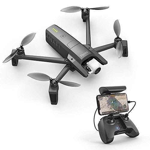
Parrot Anafi
The Parrot Anafi USA is specifically designed for professionals needing a versatile and compact drone for aerial imaging and inspection. With thermal and 32x zoom capabilities, it excels in various applications from public safety to agriculture. The Anafi USA features advanced encryption for secure data transmission, making it a reliable choice for sensitive operations. Its lightweight design and extended flight time offer unmatched flexibility and convenience, making it a standout product in the commercial drone market.
Skydio 2+
The Skydio 2+ is celebrated for its unmatched autonomous flying capabilities, making it the leader in the field of smart drones. With advanced AI technology, it can navigate complex environments and avoid obstacles seamlessly, enabling users to focus on capturing high-quality footage rather than piloting the drone. Its impressive camera system includes 4K video and HDR photography, appealing to content creators and professionals alike. This drone sets itself apart by allowing users to operate more freely while ensuring safety and precision in demanding situations.

Mining survey drones stand out with their high payload capacity, excellent GPS accuracy, and the ability to generate detailed topographical maps, ensuring effective resource management.
Benefits of Mining Survey Drones
Mining survey drones offer numerous advantages over traditional methods, enhancing both safety and accuracy in mining operations.
Drones provide high-resolution imagery and data, allowing for precise mapping and monitoring of mining sites.
They significantly reduce the time needed for surveys, enabling quicker decision-making and project planning.
Equipped with advanced sensors, drones can collect data in hard-to-reach or hazardous areas, improving safety for personnel.
Real-time data transmission allows for immediate analysis, facilitating rapid response to any issues that arise during mining operations.
The integration of AI and machine learning is optimizing data analysis from mining drones, delivering actionable insights for planning.
Regular drone surveys help maintain compliance with environmental regulations by ensuring accurate monitoring of impact areas.
Frequently Asked Questions
Which drone should miners choose for surveying fast?
For fast, detailed aerial mapping, choose the senseFly eBee Geo: it’s a fixed-wing surveying drone with high-resolution imagery and autonomous flight planning, with an average rating of 4.6.
Does the DJI Phantom 4 RTK have RTK positioning?
Yes—the DJI Phantom 4 RTK includes RTK positioning for accuracy and has an average rating of 4.7, plus a 20MP camera with a 1-inch sensor and long flight time.
How does DJI Phantom 4 RTK pricing compare value?
The DJI Phantom 4 RTK costs CA$12,677.24 and includes RTK positioning for accuracy, long flight time, and 4K camera capabilities, with an average rating of 4.7.
Is Flyability Elios 3 good for indoor mine inspections?
Yes—the Flyability Elios 3 is designed for indoor inspections in confined spaces, with a collision-tolerant design, real-time video streaming, and a compact maneuverable build; it has an average rating of 4.7.
Conclusion
In conclusion, mining survey drones are becoming an integral part of the Canadian mining industry, providing essential data that empowers operators to make informed decisions. We hope you found this information helpful in exploring the benefits of mining survey drones. If you're looking for more specific information, feel free to use the search bar!