Top 6 Navigation and Safety Tools in Canada for 2026: What Guides and Rescuers Rely On for GPS, Offline Maps, Satellite Communicators, and Emergency Gear
Published on Tuesday, February 3, 2026
This category covers the essential navigation and personal safety tools trusted by outdoor enthusiasts, guides, and search-and-rescue professionals across Canada. It includes compasses, topographic maps, handheld GPS units, dedicated offline mapping devices and apps, satellite communicators, personal locator beacons (PLBs), and multi-function emergency gear. Canadian users prioritize rugged construction for extreme weather, long battery life for remote trips, accurate offline mapping for areas without cellular coverage, bilingual interface options, and reliability under canopy and in mountainous terrain. The market appeal comes from a combination of technological reliability and practical safety benefits: devices that reduce navigation errors, improve emergency response times, and provide peace of mind for solo travellers, families, backcountry skiers, paddlers, and professional operators.
Top Picks Summary
The Silva Ranger 2.0 Global is tailored for fieldwork and search-and-rescue style navigation, featuring a large, readable baseplate, magnifier and a stable global needle for quick, accurate bearings across hemispheres. It competes with the Expedition model on practical field features but often presents a more user-friendly layout for professionals who need fast orientation, offering a middle ground between premium Suunto sighting compasses and the budget Brunton option.
Show More Compasses For Camping And Hiking
AllTrails+ Offline Maps
AllTrails+ offers an easy-to-use offline topographic map experience backed by one of the largest trail databases and extensive user reviews, making offline topo downloads simple and immediately useful for day hikers and casual outdoors enthusiasts. It is financially attractive as a single subscription that unlocks offline maps across many trails, though its topo detail and advanced export/geospatial features are less technical than Gaia or Avenza for professional mapping needs.
Show More Topographic Maps And Plotting Tools For Camping And Hiking
The ZOLEO Satellite Communicator stands out as the best smartphone‑centric option for camping and hiking by seamlessly switching between cellular, Wi‑Fi and Iridium satellite to keep messages flowing with minimal fuss. Its practical strength is a phone-first user experience and generally more budget-friendly, simplified subscription tiers compared with some dedicated Iridium devices, making it an attractive financial choice for groups who prefer app-based messaging rather than a full standalone handheld.
Show More Handheld GPS Units For Camping And Hiking
The Instinct 2 Solar offers the best value proposition for rugged hiking and camping with solar-extended battery life, military-grade durability, and practical altimeter and navigation features at a noticeably lower price than Garmin's Fenix and Epix lines. It does not match the advanced mapping or display quality of the Epix Gen 2 or the multi-band GNSS of the Vertix 2, but its combination of affordability, toughness, and long run time makes it ideal for budget-conscious outdoor users.
Show More Satellite Communicators For Camping And Hiking
The SOL Rescue Flash Signal Mirror is a lightweight, no-battery visual signaling tool that uses reflected sunlight to attract attention over long distances during daytime. Financially inexpensive and virtually maintenance-free, it provides a long-range daylight advantage compared with strobes and whistles, though it won’t work at night or send an automated distress signal like the ACR PLB or the Garmin communicator. As a compact daylight backup it pairs well with electronic devices to cover multiple signaling scenarios.
Show More Personal Locator Beacons For Camping And Hiking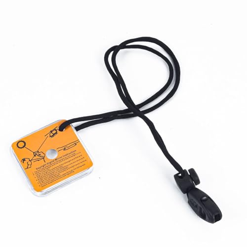
The Loksak aLOKSAK pouch is a cost-effective, airtight document protector prized for archival-quality preservation and reliable moisture barrier performance for maps and small navigation accessories. It lacks the dedicated mounting systems of Ortlieb or the roll-top flotation of Aquapac but provides superior long-term barrier protection at a low price, making it ideal for expedition caches, backup map storage and economical group use.
Show More GPS Watches And Altimeters For Camping And Hiking
Why Navigation and Emergency Devices Matter: Research-Backed Benefits
Multiple lines of research and operational reports support the benefits of modern navigation and emergency devices. Studies and post-incident analyses show that satellite-based distress systems, reliable offline maps, and properly configured GPS and PLB devices can reduce search times, improve survival outcomes, and reduce navigation-related injuries. Human factors research also highlights that combining digital tools with basic map-and-compass skills reduces error rates and increases situational awareness in complex terrain. The following findings are presented in beginner-friendly language to help buyers understand the scientific basis for choosing navigation and safety gear.
Satellite distress systems (Cospas-Sarsat and commercial satellite networks) substantially increase the probability of rescue in remote areas by transmitting a location to authorities even without cell service.
Operational reviews from search-and-rescue teams indicate that handheld GPS units and satellite communicators reduce search time when users activate distress signals and share precise coordinates.
Human factors studies show that having reliable offline maps and route plans reduces navigation errors; however, the best outcomes combine electronic tools with fundamental map-and-compass training.
Research on GPS performance identifies common limitations such as canopy and deep valley signal degradation. Devices with multi-constellation GNSS (GPS, GLONASS, Galileo, BeiDou) and barometric altimeters provide more consistent positioning in challenging conditions.
Battery reliability and cold-weather performance are critical in Canada. Laboratory and field tests demonstrate that high-capacity batteries, cold-rated designs, and power-management features extend operational time in subzero conditions.
Evidence from avalanche and winter-safety organizations shows that integrated safety systems (beacon, shovel, probe) combined with proper training lead to faster victim location and higher survival rates than equipment alone.
Frequently Asked Questions
Which tool should I buy for casual map reading?
For casual map reading, pick Coghlan's Deluxe Map Compass ($12.66 CAD): it’s a no-frills pocket compass with built-in magnifier (rating 3.8).
Does the Gem Trek Lake Louise & Yoho map handle rain?
Yes—Gem Trek Lake Louise & Yoho uses waterproof laminated paper, with detailed topographic contours and marked trailheads (rating 4.6) in a compact fold-out format.
Is Garmin inReach Mini 2 worth paying $399.99 CAD for?
At $399.99 CAD, Garmin inReach Mini 2 gives ultra-compact two-way satellite messaging and interactive SOS when paired with a smartphone, plus pairing with the Garmin Explore app (rating 4.7).
What compatibility does Garmin inReach Mini 2 require?
Garmin inReach Mini 2 pairs with the Garmin Explore app to display maps and routes from a connected phone, and it supports interactive SOS when paired with a smartphone (rating 4.7).
Conclusion
Whether you are planning day hikes in provincial parks, multi-day backcountry trips in the Rockies, or coastal paddling expeditions, choosing navigation and safety gear designed for Canadian conditions is key. We hope this guide helped you identify the right tools for your needs. If you did not find exactly what you wanted, use the site search or filters to refine by device type, battery life, offline map support, satellite network compatibility, or intended activity.