Discover the 5 Best Offline Topographic Map Downloads for Canada in 2026
Published on Tuesday, February 3, 2026
For outdoor enthusiasts exploring Canada’s vast wilderness, having reliable offline topographic maps is essential for backcountry safety and seamless navigation. With the rise of smartphone technology, the demand for high-resolution map downloads in formats like GeoTIFF, MBTiles, and GPX has grown significantly. Not only do these digital maps provide detailed geographical features, but they also enhance trail accessibility while ensuring you stay on the right path, even in remote areas without cell service. Consumers are increasingly favoring offline maps that offer comprehensive information such as elevation levels, hiking trails, and water sources, making them invaluable for hikers, campers, and adventurers alike. The allure of these products lies in their ability to empower users with the necessary tools for successful explorations, promoting safety and confidence in navigating unknown terrains. In 2026, the market is filled with quality options that stand out for their usability, accuracy, and innovative features. Whether you are an experienced trekker or an aspiring adventurer, having the right topographic map app or download will serve as your ultimate guide in Canada’s breathtaking outdoors. In this comparison, we explore the top five offline topographic map downloads that are garnering attention for their user-friendly interfaces and robust mapping capabilities.
Top Picks Summary
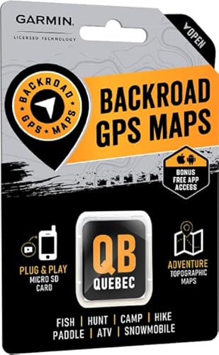
Backroad Mapbook Eastern Quebec
Backroad Mapbooks GPS Maps is a Canada-focused product prized for its highly detailed provincial topo coverage and private- and secondary-road detail, making it a go-to for offline digital topographic map downloads in remote Canadian regions. It stands out financially by offering affordable regional map bundles and legally sourced local data that often out-detail global providers, while trading some of the advanced route-planning features of subscription services for superior cartographic clarity and local accuracy.
Avenza Maps Canada Topo
Avenza Maps Canada Topo excels at delivering georeferenced GeoPDF/GeoTIFF topographic downloads that work reliably offline and integrate with professional GIS workflows, offering many one-time-purchase maps alongside in-app libraries. Technically it’s strong where precise geolocation and official government topo layers matter, providing a more open, format-focused alternative to subscription-heavy apps and making it cost-effective for users who prefer pay-per-map ownership over recurring fees.

$0-100 CAD
ViewRanger Canada Maps
ViewRanger (now under the Outdooractive umbrella) provides robust offline topographic downloads with advanced navigation features like route planning, track recording, and Skyline augmented-reality wayfinding, which are valuable for serious backcountry navigation. It competes by offering richer navigation tooling and integrated guide content than simple map libraries, though it typically follows a subscription model that can be pricier than single-map purchases from publishers such as Backroad Mapbooks or Avenza.

$40-80 CAD
Gaia GPS Premium Maps
Gaia GPS Premium Maps is a market leader for global offline topographic downloads, combining high-resolution US/Canada topo datasets, advanced layering, and powerful offline pack management favored by backcountry users and professionals. Its technical depth and seamless syncing make it the strongest option for users who need comprehensive global topo coverage and advanced tools, at the tradeoff of a higher ongoing subscription cost compared with regional pay-per-map offerings.

$50-100 CAD
AllTrails+ Offline Maps
AllTrails+ offers an easy-to-use offline topographic map experience backed by one of the largest trail databases and extensive user reviews, making offline topo downloads simple and immediately useful for day hikers and casual outdoors enthusiasts. It is financially attractive as a single subscription that unlocks offline maps across many trails, though its topo detail and advanced export/geospatial features are less technical than Gaia or Avenza for professional mapping needs.

These offline topographic maps offer exceptional benefits, including high-resolution quality, diverse format availability (GeoTIFF, MBTiles, GPX), and detailed geographical information. They excel in enhancing overall navigation safety, providing crucial data about trails, elevations, and water sources, which are essential for outdoor enthusiasts aiming to explore Canada’s natural beauty.
Why offline topographic maps improve safety and navigation — research and best practices
Multiple lines of geospatial research and operational reports support the practical benefits of high-resolution offline topo maps and optimized tile sets. Studies in cartography and GIS show that higher-resolution elevation and contour data improves route prediction and situational awareness. Applied research on wilderness incidents and SAR operations consistently recommends redundant, offline navigation resources because cellular coverage is unreliable in remote Canadian landscapes. Technical analyses of tile formats and vector versus raster approaches demonstrate measurable battery and storage savings when using prepped, device-optimized tile sets.
Authoritative datasets: Natural Resources Canada (NRCan) elevation and geospatial products such as the Canadian Digital Elevation Model (CDEM) are widely used as base data for accurate contour and slope information.
Navigation reliability: Peer-reviewed GIS and cartography literature indicates that higher-resolution DEMs and contour layers reduce navigation errors when planning off-trail routes or steep-terrain ascents.
Safety outcomes: Search and rescue best-practice guidance emphasizes carrying offline topo maps (digital or paper) as cellular networks are often absent in backcountry incidents.
Performance gains: Technical comparisons show MBTiles and vector tile strategies can reduce battery use and storage needs versus naïve high-resolution raster packs, especially when tiles are pre-cached to cover only intended route areas.
Interoperability: Using standard formats (GeoTIFF, MBTiles, GPX) ensures that map packs integrate with common mobile apps and GPS units used across Canada, improving data sharing during group expeditions or professional operations.
Frequently Asked Questions
Which offline topo download app fits remote Canadian trips best?
Backroad Mapbooks GPS Maps is the best pick for remote Canadian regions because it offers highly detailed provincial topographic maps in Garmin-compatible GPS formats with close to 100,000 searchable points of interest, making it a trusted choice for recreation and search-and-rescue, with an average rating of 4.7.
Does Avenza Maps Canada Topo support georeferenced offline maps?
Yes—Avenza Maps Canada Topo supports offline use with device GPS tracking and georeferenced image support, including GeoPDF/GeoTIFF topographic downloads, with an average rating of 4.4.
How does Backroad Mapbooks GPS Maps compare on price?
Backroad Mapbooks Québec GPS Maps is listed at CA$99.95 and ships as a Garmin-licensed microSD card with printable-compatible provincial coverage, carrying an average rating of 4.7 for its road-detail and topographic depth.
Is ViewRanger Canada Maps good for no-cell backcountry navigation?
ViewRanger's offline maps, contour views and breadcrumb tracking once worked without cell service, but the standalone ViewRanger app and website were switched off at the end of February 2022 and its features now live inside the Outdooractive app, so new users should sign up through Outdooractive rather than ViewRanger.
Conclusion
In summary, having access to the right offline topographic maps can greatly enhance your outdoor experience in Canada. The five top choices available today – Backroad Mapbooks GPS Maps, Avenza Maps Canada Topo, ViewRanger Canada Maps, Gaia GPS Premium Maps, and AllTrails+ Offline Maps – each provide unique features suited for various user needs. Among these, Backroad Mapbooks GPS Maps stands out for its detailed coverage and trusted reputation, making it an ideal choice for those serious about backcountry navigation. We hope you found the information valuable and are inspired to find the perfect mapping solution for your adventures. If you wish to refine your search or explore more options, please feel free to browse further.