Printable Custom Route Topographic Maps Canada 2026 — Top 5 Trusted Tools for Print-Ready, Route-Editable Topos (Backroad Mapbooks, CalTopo, AllTrails+, Avenza, Gaia GPS)
Published on Monday, February 2, 2026
Customizable, print-ready topographic maps that let you draw routes, add waypoints, elevation profiles, and distance markers before exporting as PDF or image files are increasingly popular across Canada for pre-trip planning, group handouts, and multi-day itinerary prep. These tools appeal to outdoor enthusiasts, guiding services, search-and-rescue-aware trip leaders, and remote-area travellers because they combine precise topographic data, easy route editing, and reliable offline output. In Canada—where mobile coverage is often limited and terrain ranges from coastal fjords to boreal backcountry and alpine zones—users prioritize clarity, scale accuracy, durable print outputs, and the ability to tailor maps for specific trail sections, portages, or daily plan segments. The category meets those needs by offering layer control, elevation profiling, distance measurement, and export settings tuned for printed handouts and field use.
Top Picks Summary
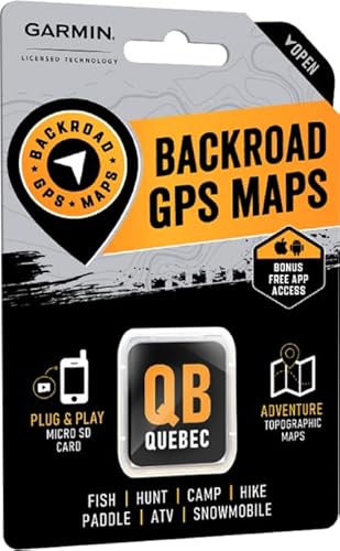
Backroad Mapbook Eastern Quebec
Backroad Mapbooks is known for high-quality, region-focused printed maps and mapbooks that make printable custom route topographic maps immediately usable without heavy digital setup. Its strength is in affordable, ready-to-print physical cartography and curated regional detail, which is often easier and cheaper for travelers than building a map from scratch in CalTopo or subscribing to premium services. Compared with Avenza and Gaia, Backroad Mapbooks prioritizes print clarity and local route context over deep on-device customization or layered export controls.
CalTopo Desktop
CalTopo Desktop is best-in-class for printable custom route topographic maps because it offers the most advanced layer control, map styling, and high-resolution PDF export options for professional-grade prints. Its technical flexibility and generous free tier (with optional paid upgrades for higher-resolution exports) make it the go-to choice for users who need precise contour, shading, and annotation control that simpler services like AllTrails or Gaia do not provide. While Avenza excels at geo-referenced PDFs for mobile use, CalTopo outperforms on raw print customization and fine-grained cartographic tools.

$0-90 CAD
AllTrails+ Offline Maps
AllTrails+ Map Downloads focuses on simplicity and community-sourced routes, providing an affordable subscription path to offline and printable map downloads for casual hikers and recreational users. Its financial advantage is a straightforward subscription model that bundles map downloads, GPX export, and trail difficulty data at a lower onboarding cost than purchasing many individual map packs, though its print customization and resolution controls are less advanced than CalTopo. For users who prioritize quick route discovery and easy exports over professional print styling, AllTrails+ is a cost-effective middle ground compared with Avenza and Gaia.

Avenza Maps PDF Maps
Avenza Maps specializes in geo-referenced PDF maps and excels at delivering printable PDFs that retain spatial metadata for in-field GPS use, making it a standout when you need both a print and an interactive PDF package. Its marketplace model and pay-per-map options can be financially advantageous for one-off purchases, and the embedded georeferencing offers a technical edge for workflows that require printed maps to remain coordinate-aware in apps. Compared with CalTopo's deep styling toolkit, Avenza trades some customization for seamless PDF distribution and mobile-compatible, printable map files.
$0-70 CAD
Gaia GPS Premium Topo Maps
Gaia GPS Premium combines a wide selection of high-quality topo basemaps with strong mobile sync and cloud route planning, making it an excellent all-around choice for printable custom route topographic maps tied to a device-first workflow. Its subscription model bundles access to multiple map sources and straightforward print/export tools, offering good value for backcountry planners who want reliable basemap aesthetics without the steep learning curve of CalTopo. While not as granular in print styling as CalTopo or as PDF-focused as Avenza, Gaia provides the best balance of map quality, cross-device convenience, and predictable annual pricing.

$60-140 CAD
Why Printable Custom Route Topo Maps Work — Evidence and Practical Benefits
Research in cognitive science, outdoor safety practice, and navigation studies supports the practical advantages of combining custom route planning with printed topographic output. Paper and well-designed printouts help build mental maps, improve situational awareness, and provide a resilient backup when electronics fail. Trip planning that includes elevation profiles and distance segmentation leads to better pacing and risk management. Parks, guiding associations, and search-and-rescue recommendations across Canada emphasize carrying reliable maps and written plans as part of good trip preparation.
Cognitive mapping: Studies in wayfinding and spatial memory show that active map reading and drawing routes improves recall and orientation compared with passive screen-only navigation.
Resilience: Outdoor safety guidance and search-and-rescue protocols recommend paper maps and written routes because digital devices can lose power, signal, or functionality in remote Canadian terrain.
Planning and exertion: Using elevation profiles and distance markers helps predict energy expenditure and daily goals, reducing the likelihood of overdue returns and emergency scenarios.
Group coordination: Printed, scaled maps improve group communication and decision-making on multi-day trips or guided outings where several people need the same reference.
Accuracy and cartography: High-resolution topo layers and custom scale settings let users generate maps that reflect local contour detail and important topographic features relevant to route choice.
Frequently Asked Questions
Which tool should I use for printable custom topos?
Choose CalTopo Desktop if you want printable custom route topographic maps with advanced layer control and high-resolution PDF export; it’s rated 4.5 and includes hillshade and contour control plus scale-ready exports.
Does CalTopo Desktop support contour and hillshade control?
Yes—CalTopo Desktop includes hillshade and contour control in its layer-based desktop map composer, and it supports high-resolution PDF/PNG export plus scale controls for print-ready custom route topos.
How does Backroad Mapbooks pricing compare to CalTopo Desktop?
Backroad Mapbooks GPS Maps lists at CA$99.95 and focuses on professionally drawn printed regional topographic atlases plus downloadable GPS-ready PDF products; CalTopo Desktop is rated 4.5 but no price is provided here.
Is AllTrails+ good if I want offline printable maps?
AllTrails+ is designed for casual hikers: the subscription unlocks downloadable offline topo maps, printable maps, and direct GPX exports, and the listing here carries a 4.5 average rating.
Conclusion
Across Canadian outdoor uses, the five tools profiled here cover the most common needs: Backroad Mapbooks GPS Maps for Canada-focused atlases and printable regional grids; CalTopo Desktop for advanced, layer-driven custom printing and route editing; AllTrails+ Map Downloads for casual-to-serious users who want quick downloadable topos; Avenza Maps PDF Maps for seamless PDF import, annotation, and offline distribution; and Gaia GPS Premium Topo Maps for mobile-first planning with strong sync and export options. For users who want the deepest control over printable route customization and professional-grade export options, CalTopo Desktop is often the best choice; for Canada-specific atlas formats and ready-made regional coverage, Backroad Mapbooks is a top fit. I hope you found what you were looking for — use the search box to refine or expand your results by region, activity (hiking, canoe, backcountry ski), export type (PDF, image), or scale to pinpoint the ideal printable custom route topo map for your trip.