Top 3 Urban Planning Drones in Canada — 2026 Guide
Published on Friday, January 23, 2026
Urban planning drones assist in the development and management of urban areas by providing high-resolution aerial data for infrastructure projects, land use planning, and urban modeling. In Canada, municipalities, consultants, and provincial authorities increasingly choose drones for site surveys, 3D mapping, construction monitoring, and environmental risk assessment because they deliver faster, safer, and more cost-effective data than many traditional methods. Buyers in this market prioritize sensor accuracy (LiDAR and photogrammetry), RTK positioning, flight time and reliability, software and GIS integration, compliance with Transport Canada rules, and local support in both English and French. For 2026, the most popular urban planning drone packages combine robust hardware, validated sensors, industry-standard data workflows, and cloud or desktop tools that plug directly into common GIS and CAD systems.
Top Picks Summary
The Mavic 3 Enterprise is a best-in-class choice for land use planning when portability and high-resolution imaging are priorities, offering a compact, survey-capable platform that balances cost and performance. It undercuts larger platforms like the Matrice 350 RTK on price and logistical complexity while delivering better on-site flexibility than fixed-wing systems such as the senseFly eBee X, making it ideal for frequent, small-to-medium survey areas and rapid field checks. Compared with the Phantom 4 RTK and Autel EVO II Pro Enterprise, it provides a modern combination of sensor quality and ease-of-deployment that reduces operational time and per-survey expense for planners.
Show More Infrastructure Inspection Drones
The Skydio X10 prioritizes autonomous flight and industry-leading obstacle avoidance, making it particularly effective in complex urban and confined-area public safety operations where reducing pilot workload and mission risk is critical. Compared with sensor-rich platforms such as the Matrice 30T or Autel’s thermal models, the X10 focuses on lowering operational and training costs through AI-driven navigation — a tradeoff that benefits teams needing autonomy-first performance more than those requiring the widest possible sensor suite.
Show More Traffic Management Drones
$12,000-16,000 CAD
The Autel EVO II Pro delivers high-resolution RGB imagery with an attractive cost-to-image-quality ratio for detailed vegetation mapping and rapid inspections of urban green infrastructure. It competes financially with the Mavic 3 Multispectral by offering strong RGB performance at a lower price, but it lacks integrated multispectral sensors and the enterprise RTK/payload modularity offered by the DJI and senseFly systems.
Show More Land Use Planning Drones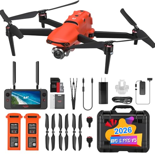
Research and Evidence: How Drones Improve Urban Planning
Scientific research and applied studies from Canadian universities, government agencies, and industry pilots show that unmanned aerial systems provide measurable benefits for urban planning. Key findings emphasize improved spatial resolution, faster data collection cycles, reduced field risk, and enhanced capacity for producing digital twins and predictive models. These advantages translate into better-informed decisions for zoning, transportation design, stormwater management, and climate resilience planning.
Improved survey speed and coverage: Peer-reviewed and municipal case studies report that drones can map sites in hours that would take days with ground surveys, accelerating project timelines.
Higher-resolution mapping: LiDAR-equipped drones and high-resolution photogrammetry produce dense point clouds and orthomosaics that enable centimeter-level analysis for as-built verification and 3D modeling.
Cost efficiencies: Comparative analyses show reduced labor and equipment costs versus manned aircraft and some traditional survey methods, particularly on small to medium urban projects.
Risk reduction and safety: Aerial data collection minimizes the need for staff to access hazardous or congested urban areas, lowering exposure to traffic and site hazards.
Better climate and hazard planning: Studies using drone-derived elevation and thermal data support flood mapping, stormwater design, and urban heat island analysis, helping planners target mitigation measures.
Integration with digital workflows: Research highlights the benefits of seamless GIS, BIM, and CAD integration, enabling planners and engineers to use drone outputs directly in modeling, asset management, and public consultation.
Frequently Asked Questions
Which drone should I buy for urban planning surveys?
Choose the DJI Matrice 350 RTK for complex, high-accuracy land use planning because it has modular payload bays, built-in RTK/PPK, and redundant flight systems; it’s rated 4.7.
Does Autel EVO II Pro capture 6K RGB imagery?
Yes—Autel EVO II Pro uses a 6K/20MP adjustable-aperture camera to capture detailed RGB imagery for canopy and tree health analysis; it’s rated 4.3.
Is Autel EVO II Pro cheaper than the alternatives?
Autel EVO II Pro lists at $4,459.25 and is positioned as a strong cost-to-image-quality option for vegetation mapping, while only it has a stated price here; it’s rated 4.3.
What’s better for obstacle-heavy urban missions, Skydio X10?
Skydio X10 is built for complex urban scenes with multi-directional obstacle avoidance and autonomous flight, plus multi-sensor payload support; it’s rated 4.6.
Conclusion
Urban planning drones are a practical, increasingly mainstream tool for Canadian planners, engineers, and consultants. We hope this guide helped you identify the top 5 drone options tailored for urban projects in Canada for 2026. If you want to refine results by sensor type, flight time, budget, regulatory readiness, or local support, use the site search to narrow or expand your options.