Best Green Space Planning Drones in Canada — Top 5 for 2026
Published on Friday, January 23, 2026
Green Space Planning Drones play a crucial role in urban horticulture and park development across Canada by enabling fast, accurate mapping and monitoring of vegetation, canopy structure, soil moisture and microclimates. For 2026, municipalities, landscape architects, urban foresters and environmental consultants increasingly choose drones that combine multispectral and high-resolution RGB imaging, RTK/PPK positioning or LiDAR to assess existing green areas and plan new parks that support biodiversity and urban resilience. Canadian buyers prioritize reliability in variable weather, sensor compatibility for NDVI and thermal analysis, robust flight time for covering large parklands, tight horizontal accuracy for design-grade mapping, and strong local support and compliance with Transport Canada regulations. These preferences favor platforms that are easy to integrate with common mapping and GIS workflows, offer proven data quality, and deliver a clear return on investment for both large municipal projects and smaller private developments.
Top Picks Summary
DJI Mavic 3 Enterprise
The Mavic 3 Multispectral is DJI's compact multispectral platform optimized for green space planning, offering integrated RGB and multispectral sensors for rapid NDVI and vegetation-health mapping. It stands out for portability and lower acquisition and operational costs for small-to-medium urban parks compared with larger systems like the senseFly eBee X, while providing more targeted multispectral data than general-purpose imagers such as the Autel EVO II Pro.

$6,000-8,000 CAD
DJI Matrice 350 RTK
The Matrice 350 RTK is DJI's enterprise-grade quadcopter combining long endurance, RTK positioning and flexible payload support, making it the market-leading choice for large-scale green space surveys and LiDAR or multisensor integrations. Its technical advantage is superior flight time and modularity versus consumer multirotors and lower long-term cost-per-survey on frequent professional jobs compared with single-purpose fixed-wing platforms like the eBee X.

senseFly eBee X
The senseFly eBee X is a fixed-wing mapping drone prized for covering large green spaces per flight, significantly reducing operational time and cost for area-wide photogrammetry tasks. It holds the niche for large-area efficiency and photogrammetry-grade imagery, though it sacrifices vertical takeoff flexibility and on-site payload swapping that multirotor platforms such as the Matrice 350 RTK and Phantom 4 RTK provide.

$20,000-35,000 CAD
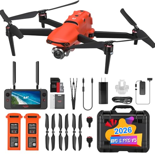
Autel Robotics EVO II Pro V3
The Autel EVO II Pro delivers high-resolution RGB imagery with an attractive cost-to-image-quality ratio for detailed vegetation mapping and rapid inspections of urban green infrastructure. It competes financially with the Mavic 3 Multispectral by offering strong RGB performance at a lower price, but it lacks integrated multispectral sensors and the enterprise RTK/payload modularity offered by the DJI and senseFly systems.
DJI Phantom 4 RTK
The Phantom 4 RTK is a survey-focused platform that combines an affordable, easy-to-deploy airframe with integrated RTK for survey-grade geotagging, making it a practical choice for precise orthomosaic production in green space planning. It occupies a middle ground by delivering better positional accuracy than consumer cameras like the EVO II Pro and Mavic 3 Multispectral while remaining less costly and less modular than heavy-duty systems such as the Matrice 350 RTK or the long-endurance eBee X.

Scientific support for drones in green space planning
A growing body of research and operational reports shows that aerial remote sensing from drones significantly improves the speed, resolution and repeatability of vegetation and site assessments compared with traditional ground surveys. Studies highlight the value of multispectral sensors and LiDAR for measuring plant health, canopy height and structure, and thermal and multispectral data for irrigation planning and urban heat island analysis. Canadian agencies and research groups have adopted drone-based workflows for urban forest inventories, wetland assessments and restoration planning, demonstrating practical benefits for planning and long-term monitoring.
Vegetation indices such as NDVI and VARI derived from multispectral drone imagery provide objective, repeatable measures of plant health and stress that inform planting and maintenance decisions.
LiDAR-equipped drones accurately measure canopy height and vertical structure, improving biomass estimates and helping prioritize tree preservation or planting zones.
Thermal imaging from drones supports irrigation efficiency and urban heat mapping, which are important for designing parks that reduce local temperatures and support climate adaptation.
Operational studies show drone surveys reduce field time and overall project cost compared with traditional survey methods, while increasing spatial resolution and frequency of monitoring.
Consistent seasonal drone monitoring enables early detection of pests, disease and invasive species, helping municipalities and landscape teams respond faster and more effectively.
Frequently Asked Questions
Which drone should I buy for park NDVI mapping?
Choose the DJI Mavic 3 Multispectral for rapid NDVI and vegetation-health mapping, since it has an integrated multispectral sensor with RGB plus five spectral bands and a compact, foldable design for quick deployment across urban parks.
Does the DJI Mavic 3 Multispectral support NDVI accurately?
Yes—the DJI Mavic 3 Multispectral includes five spectral bands for NDVI and plant-health monitoring, plus integrated RGB imaging, and it supports RTK/PPK workflows and geotagging for survey-grade mapping accuracy.
Is the DJI Matrice 350 RTK worth paying $790.51?
At $790.51, the DJI Matrice 350 RTK gives built-in RTK positioning, a rugged enterprise airframe with high payload capacity for LiDAR/multisensor/thermal sensors, and long endurance with hot-swappable batteries for extended missions over large green infrastructures.
Is the senseFly eBee X better than quadcopters?
For covering large green spaces efficiently, the senseFly eBee X uses a fixed-wing design for long flight times and wide coverage, with interchangeable payload options like high-resolution RGB and multispectral sensors for area-wide photogrammetry and orthomosaic production.
Conclusion
In the Canadian context, Green Space Planning Drones help make park design, urban forestry and ecological restoration more data driven and cost effective. The five top platforms for 2026 presented here are DJI Mavic 3 Multispectral, DJI Matrice 350 RTK, senseFly eBee X, Autel EVO II Pro and DJI Phantom 4 RTK. Each model serves different needs: the senseFly eBee X excels at covering very large areas, the Mavic 3 Multispectral and Phantom 4 RTK are compact multispectral and survey-ready options, and the Autel EVO II Pro balances image quality and cost. For most Canadian municipal planners and professional consultants who need high accuracy, rugged performance and broad sensor support, the DJI Matrice 350 RTK stands out as the best overall choice. I hope you found what you were looking for; use the site search to refine by sensor type, flight time, coverage area or budget to expand your options.